By Hugh Rogers
Last month, the Go North Alliance, an informal organization of statewide, regional, and local nonprofits, including the West Virginia Highlands Conservancy, as well as Tucker County businesses and individuals, formally requested a scoping process on the Supplemental Environmental Impact Statement (SEIS) for the Parsons to Davis Project.
Scoping determines the range of analysis necessary for an informed decision on a proposed action and sets out how the agency will go about that process. Crucially, it includes public involvement. It is supposed to aid in the development of alternatives. It is not supposed to define the project’s scope so narrowly that only one alternative could work.
We contended that a new scoping process should take into account the substantial changes that have occurred within the area and take advantage of the dramatic improvements in digital mapping techniques and access to information.
The original scoping for the Appalachian Corridor H project was done in the early 1990’s. Back then, its purpose and need assumed it would connect to I-81 in Virginia. That terminus has been foreclosed by Virginia’s decision not to build a four-lane parallel to Rt. 55. More generally, Corridor H was intended to “improve east-west transportation” through the region. Almost any highway upgrade might achieve that vague prescription.
The other two elements of purpose and need were to “promote economic development” and “preserve or improve the quality of life in the region.”
We argued that scoping should be sensitive to the economic developments that have already occurred and the special quality of life here. Both would suffer from a badly planned project.
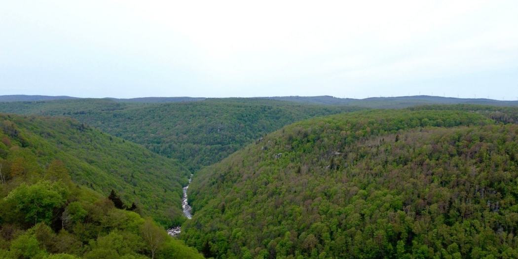
Among other notable changes, severe population loss (more than 20% from 1990 to 2000) has been reversed, and the number of businesses has doubled in Thomas and Davis. New analysis should focus on an alignment that will be most compatible with a thriving tourist economy. The natural beauty and many activities this area provides draw ever more people. The environment we are blessed with is vulnerable. “One size fits all” highway projects are inappropriate here. Poor placement, by itself, would be ruinous.
Not surprisingly, during the lengthy period since the previous SEIS (2007), there have been significant changes in other relevant circumstances. The original Northern alternatives (officially “Blackwater Avoidance Alternatives”) were distorted by a vain effort to achieve protection for an endangered species, the West Virginia Northern Flying Squirrel, which has since been de-listed. The study area for alternatives was expanded into environmentally vulnerable territory. We asked for a renewed focus on the study area for the Thomas-Davis section of the project, as specified in the Settlement Agreement.
For the Council on Environmental Quality, which coordinates environmental protection throughout the federal government, examination of alternatives is “the heart of the NEPA process.” A Northern route is the obvious alternative, we said, and it should be examined at the same level of detail as the Revised Original Preferred Alternative (ROPA).
We acknowledged that scoping is not automatically required for a supplemental EIS, but in this case, there were a number of reasons why it would be beneficial to do so, and it would lead to a better final decision on the remaining Corridor H Parsons-to-Davis section.
None of this was a surprise to Jason Workman, Director of Program Development at the Federal Highway Administration’s (FHWA’s) Charleston office. He quickly got to the point: FHWA and the West Virginia Division of Highways are developing a notice of intent (NOI) for Parsons to Davis supplemental EIS. The NOI is expected to be published in the Federal Register later this year and will provide additional scoping information. However, I wanted to let you know that the SEIS will include study of a Blackwater Avoidance Alternative.
So that’s the good news, for which we are grateful. Now, what can we expect?
I anticipate a straight-up comparison of the ROPA with a Northern alternative will result in a decision to choose the latter. Such a result was forecast 20 years ago when the Division of Highways (DOH) released its first Preferred Alternative Report. The Environmental Protection Agency recognized that the ROPA had “considerably more environmental impacts,” and it urged the DOH to reconsider. Our state Division of Natural Resources concurred.
Since then, the DOH has worked on tweaking the ROPA to make it more acceptable. To us, these changes have seemed relatively minor, and the ROPA’s predicted effects on streams, wetlands, floodplains, and public lands continue to be worse than the Northern alternative. But DOH has insisted that the ROPA has one great advantage: its lower cost.
Friends of Blackwater has commissioned a report by an engineering firm that has been involved in other Appalachian Development Highway System projects. We’ll have more to say in the future about the local implications of its work on North Carolina’s Corridor K. The report was not complete at this writing.
A final argument in favor of any Northern alternative is Section 4(f) of the U.S. Department of Transportation Act of 1966, which mandates that FHWA “cannot approve the use of land from . . . historical sites” unless either (a) there is no feasible and prudent alternative to the use of the land, or (b) the use of the property will have a de minimis impact.
Based on DOH’s previous exploration of Blackwater Avoidance Alternatives in the 2002 Draft and 2007 Final SEIS, as well as work done so far by the engineering firm mentioned above, it seems obvious that a “feasible and prudent alternative” will be found.
Up to now, DOH has avoided that issue, relying on the State Historic Preservation Officer’s increasing willingness during the 1990’s to define the Blackwater Industrial Complex as a “discontinuous” historic district. That interpretation would allow encroachments, even a four-lane highway bridge, as long as they didn’t affect “contributing elements” such as the original coke ovens.
Meanwhile, the Keeper of the National Register of Historic Places, an office within the federal Department of Interior, was engaged in its own determination of eligibility for the Register and thus for protection by Section 4(f). That effort came to a head in 2001. The Keeper’s staff visited the district and conferred with the relevant parties, including the Forest Service, owner of the property. John Calabrese, the Forest Archaeologist, wrote, “The notion that Coketon is part of a discontinuous historic district is, from our point of view, inconsistent with previous opinions expressed by the Forest Service, the WVSHPO, and your office.”
The Keeper agreed. In its Determination of Eligibility Notification, it stated, “Post-mining reclamation of a relatively small area has not significantly disturbed the Coketon resources in a manner that would necessitate Coketon’s evaluation as a discontiguous district, nor does it support the evaluation of the Blackwater Industrial Complex as a discontiguous district.”
Subsequent negotiations between DOH and the Forest Service on mitigation of the highway’s impacts have muddied the waters. To be clear: if there is a “feasible and prudent alternative”, Section 4(f) requires its selection. No mitigation is necessary. Nor could the ROPA be approved under the other exception, “de minimi2s impact.” Clyde Thompson, then Forest Supervisor, made that clear in a 2002 letter to the DOH: “whatever the final design of the piers and span, a bridge of the proportions necessary for this project cannot fail to have an adverse effect on the integrity of setting, feeling, and, possibly, association of the site.”
What is true of the historic site is also true of our community now: putting a four-lane divided highway and a separate new truck route between the towns and close to our premier state park cannot fail to have an adverse effect on the integrity of their setting, feeling, and association.
We look forward to the outcome as our federal and state highway agencies devise and seriously consider an alternative route to preserve this special place.
Photo by Frank Gebhard, Friends of Blackwater.