By Hugh Rogers
Recent visitors to Tucker County asked us about the Facebook page of Corridor H Authority, a quasi-official public relations group. They thought it looked pretty good. It said, “the West Virginia Division of Highways has modified and improved the Revised Original Preferred Alternative.”
We replied that “modifications” can’t change the fact that it’s still the original alignment, and it’s still in the wrong place.
If you look back at the project’s re-start, after our lawsuit, the 2000 Settlement Agreement required the Division of Highways to find alternatives for “the Thomas-Davis Section of the Parsons-to-Davis Project.” That’s all. It did not call for a lengthy detour beyond the high school, then through drastic cuts and fills and across pristine streams on Backbone Mountain. Tacking that western section on the northern alternative was designed to fail.
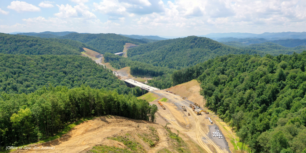
It helps to remember this history when you look at the Corridor H Authority’s nine points meant to show why the Revised Original Preferred Alternative, or proposed route, is better. The claims in the first three points fall apart if you remove the section west of Benbush. More bridges? Higher elevation? More intersections with United States Route 219? They have nothing to do with the northern route around Thomas. The claim that the preferred route is safer because it has fewer curves is imaginative, at least. How do they know? There is no final design yet for either alternative.
The proposed route, they say, won’t “divide” the towns because it has been redesigned to go under, not over, a bridge carrying Route 32. Over or under, Corridor H would be an intrusive and unnecessary interruption of the familiar landscape.
Would the proposed route reduce traffic in Thomas? Yes, but its truck route would dump the trucks back on Route 32 and force them through a complicated intersection at Davis to get on the Corridor. The northern route is simpler and safer.
As for the claim that proposed route would have fewer impacts on forests and streams, the Division of Highway’s own analysis shows the opposite is true. And the viewshed of Blackwater Falls State Park? A spatial analysis by a West Virginia University professor shows the highway would be visible from many places in the park.
For the problem of acid drainage caused by construction in the old mining areas, the proposed route seems to rely on a water treatment plant upstream of a bridge over the Blackwater. That plant, already planned, would have to add more capacity (and cost) if the proposed route was built.
Finally, the Corridor H Authority claims that the proposed route would “highlight” historical features such as the coke ovens and the Coketon Colored School while building a highway above them.
Twenty-some years ago, the Monongahela National Forest Supervisor, responsible for the land on which these features rest, wrote: “whatever the final design of the piers and span, a bridge of the proportions necessary for this project cannot fail to have an adverse effect on the integrity of setting, feeling, and possibly association of the site.”
That would threaten its status on the National Register of Historic Places. More importantly, it would diminish its appeal, not only as a historic site but as an approach to Douglas Falls and the Blackwater Canyon rail-trail.
The best route is to Go North around Thomas. Section by section is how Corridor H has been built. Meanwhile we can design a shorter, less damaging, more sensible route down the mountain toward Parsons.
Here are ten reasons to Go North:
- Go North! A large majority of locally owned businesses and Chamber of Commerce members know it’s better for their livelihoods and the region’s economic health.
- Go North! 88 of every 100 commenters asked for the northern route when the Division of Highways renewed the project in 2019.
- Go North! Don’t put a big highway between our towns, either over or under Rt. 32.
- Go North! It provides better access for Thomas and is an efficient bypass for through-traffic.
- Go North! It’s the best access for Davis and avoids through-traffic noise and lights.
- Go North! Save the Blackwater River trail and historic site from an intrusive, noisy bridge.
- Go North! Don’t degrade the scenic, rural character of Blackwater Falls, West Virginia’s most-visited State Park, with a noisy, intrusive four-lane freeway.
- Go North! It will bring visitors to our door and welcome them—it won’t “wreck the house.”
- Go North! It’s the only way to fulfill our towns’ plans for the future.
Davis: “Protect existing assets: the natural landscape and rural beauty, dark skies, community centers and parks, the small-town atmosphere and safe environment for children.”
Thomas: Preserve a “greenway” between the towns – not a truck route. - Go North! It preserves more streams and wetlands according to the Division of Highway’s own analyses.